 |
Pole Creek Wilderness |
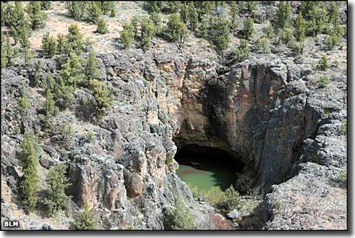 A volcanic pothole in Pole Creek Wilderness |
|
Pole Creek Wilderness is comprised of about 12,533 acres of BLM property containing certain small private inholdings. The landscape is diverse, ranging from grassland plateaus to deep canyons with vertical walls of basalt and rhyolite. Some of the canyon walls rise more than 1,000' from their base but most are in the 600' to 800' range. Some areas sport a reasonable cover of juniper woodland, some areas see Ponderosa pines. Most areas are good habitat for pronghorn antelope, sage grouse, bighorn sheep, cougar, coyote and the ubiquitous jackrabbit. There aren't a lot of trails in the area but the Owyhee Uplands Back Country Byway does run along a section of cliffs at the northern end of the property. Most folks come to check out the whitewater rafting. Best season on the rivers: April and May. |
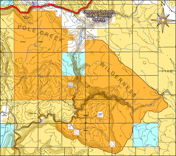 Map of Pole Creek Wilderness 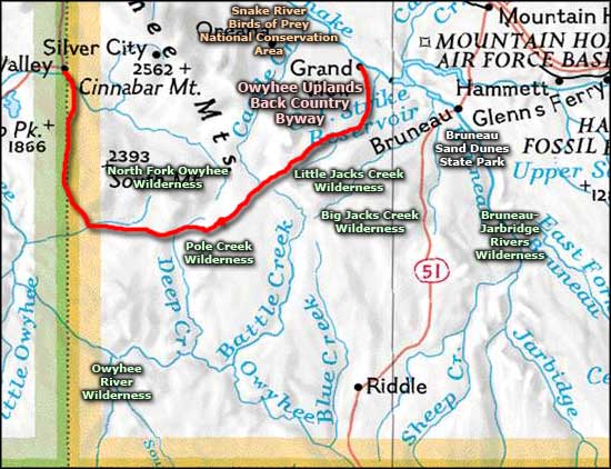 Pole Creek Wilderness area map |
|
|
Pole Creek Wilderness Related Pages
Big Jacks Creek Wilderness - Owyhee Uplands Back Country Byway
Bruneau-Jarbridge Rivers Wilderness - Little Jacks Creek Wilderness Owyhee River Wilderness - North Fork Owyhee Wilderness Birds of Prey National Conservation Area - Bruneau Dunes State Park Idaho Pages |
 |
| Index - Arizona - Colorado - Idaho - Montana - Nevada - New Mexico - Utah - Wyoming National Forests - National Parks - Scenic Byways - Ski & Snowboard Areas - BLM Sites Wilderness Areas - National Wildlife Refuges - National Trails - Rural Life Advertise With Us - About This Site - Privacy Policy |
| Upper photo and big map are courtesy of the Bureau of Land Management. Area map courtesy of National Geographic Topo! Text Copyright © by Sangres.com. All rights reserved. |