 |
North Fork Owyhee Wilderness |
 In the North Fork Owyhee Wilderness |
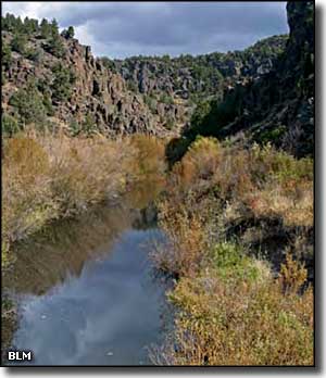
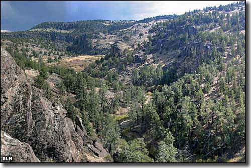
The North Fork Owyhee Wilderness is comprised of 43,413 acres in the drainage of the North Fork of the Owyhee River. The countryside here is a mix of deeply eroded canyons with steep walls separating plateaus covered with grasslands and dense sagebrush. A lot of the region is excellent habitat for pringhorn antelope, bighorn sheep, sage grouse and numerous raptors. Some of the deep-cut rhyolite and basalt canyon walls exceed 1,000' in height. Higher areas see a good cover of Ponderosa pine with juniper woodlands below that and big sagebrush below that. Rivers in the wilderness offer rapids up to Class IV. The North Fork of the Owyhee River has about 15 miles designated as "wild and scenic river." 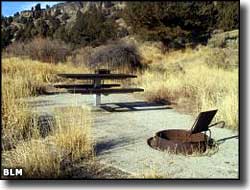
The North Fork Campground is right off the Owyhee Uplands Back Country Byway about 27 miles southeast of Jordan Valley, Oregon. The campground is also right at the western boundary of the North Fork Owyhee Wilderness. This is a developed campground with seven primitive campsites with picnic tables, fire grates and one vault toilet. There's no potable water on-site and there's a seven-day stay limit. Most foklks use the campground in spring, summer and fall but the campground can be reached from the Oregon direction year-round. |
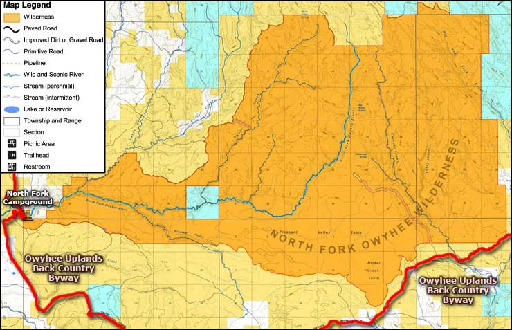 North Fork Owyhee Wilderness map 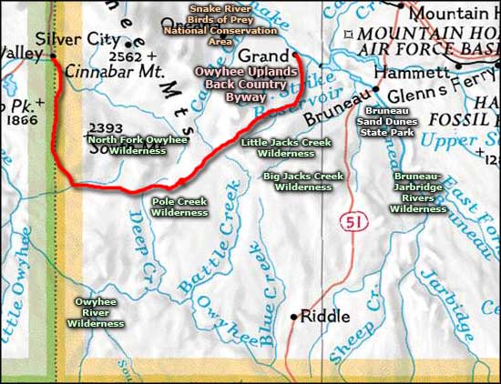 North Fork Owyhee Wilderness location map |
|
|
North Fork Owyhee Wilderness Related Pages
Big Jacks Creek Wilderness - Owyhee Uplands Back Country Byway
Bruneau-Jarbridge Rivers Wilderness - Pole Creek Wilderness Owyhee River Wilderness - Little Jacks Creek Wilderness Birds of Prey National Conservation Area - Bruneau Dunes State Park Idaho Pages |
 |
| Index - Arizona - Colorado - Idaho - Montana - Nevada - New Mexico - Utah - Wyoming National Forests - National Parks - Scenic Byways - Ski & Snowboard Areas - BLM Sites Wilderness Areas - National Wildlife Refuges - National Trails - Rural Life Advertise With Us - About This Site - Privacy Policy |
| Photos and map courtesy of the Bureau of Land Management. Area map courtesy of National Geographic Topo! Text Copyright © by Sangres.com. All rights reserved. |