 |
Fort Henry Historic Byway |
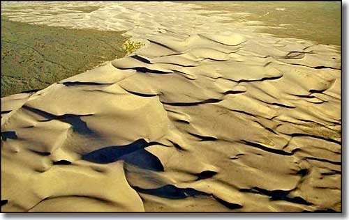 The St. Anthony Sand Dunes |
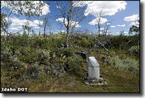
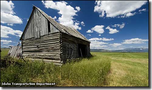
Fort Henry was the first European settlement in Idaho, but as a town, it's long gone. The small settlement was named for Andrew Henry, a mountain man and fur trapper who was also part of Lewis & Clark's Corps of Discovery. All there is today marking the spot are a couple of memorials: one old and one a bit newer. Anyway, one end of the Fort Henry Historic Byway is at Rexburg and the other end is at Island Park, about 81 miles away. Going north out of Rexburg on the Salem Highway you'll be crossing through the St. Anthony Sand Dunes, an interesting collection of sand dunes caused by the wind dropping whatever sand it carries before it can cross all those mountains to the north and east (north is the Centennials, east is the Tetons). Most of the sand was left behind some 10,000 years ago when Ice Age Lake Terreton started to recede (the biggest remnant now is probably Mud Lake, west of Hamer near Camas National Wildlife Refuge). The sandy beaches left behind slowly blew eastward until the sand ran into that problem with the mountains. Some of the dunes are up to 400' tall. (This is a BLM Recreation Area so there's parking and toilets, etc.) For a distance along here, the road skirts the eastern edge of the Sand Mountain Wilderness Study Area. The Fort Henry Historic Byway then crosses the Camas Meadows, crosses Camas Creek and then bumps up against the Lost Gold Trails Loop for a few miles, passing through the ghost town at Idmon before turning east near Kilgore. This is on the A-2 County Road: there's a gravel and dirt section for about 11 miles from Kilgore east to the Fremont County Line, then the road is paved again to US Highway 20, just north of Island Park. Just after you hit pavement again you should start seeing signs for Harriman State Park, to the south on Island Park Reservoir. The main route of the byway continues straight ahead to US 20. Along the A-2 road you'll see lots of remnants of old homesteads, historic ranches and small pioneer ghost towns, like Idmon. You'll also pass the site of the Camas Meadows Battleground. In 1877, the fleeing Nez Perce won a tactical advantage here when they got away with most of the horses and pack animals the US Army was using to chase them with. The Army had to slow down their pursuit and the Nez Perce made it into Yellowstone where they disappeared for a while. Most of this drive is in that interesting geological formation known as the Island Park Caldera. You are due west of Yellowstone Lake in Yellowstone National Park. This is where that "hot spot" that now sits under the Yellowstone caldera was millions of years ago. Once upon a time this was another big mining area but like most of the hard rock mining in Idaho, this area petered out long ago. Those mountains to the north are the Centennials, rugged and virtually empty. On the other side of those is the famous Red Rock Lakes National Wildlife Refuge (and Wilderness). The last 20 miles or so of the Fort Henry Historic Byway are definitely within the boundaries of the Greater Yellowstone Ecosystem: a region of relatively undisturbed countryside. The mountains, forests and waters in this area are just about as they have been since the end of the last Ice Age. It's an absolutely gorgeous area filled with all the elements that world-class sportsmen dream of... Best time to drive this road: mid-April to mid-November. In winter a lot of the road is snowmobile trails only. |
 Idmon town site 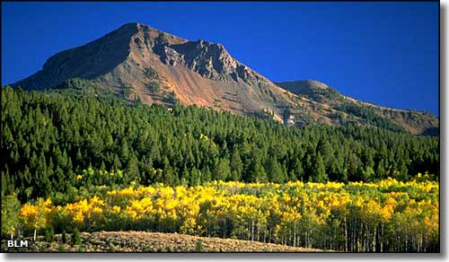 The Centennial Mountains 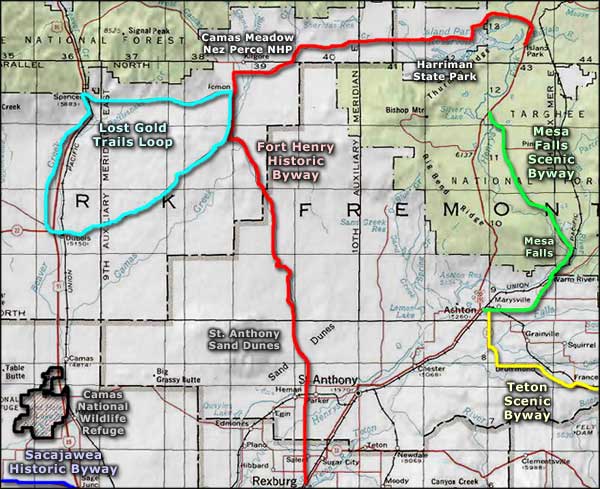 Fort Henry Historic Byway area map |
|
|
 |
| Index - Arizona - Colorado - Idaho - Montana - Nevada - New Mexico - Utah - Wyoming National Forests - National Parks - Scenic Byways - Ski & Snowboard Areas - BLM Sites Wilderness Areas - National Wildlife Refuges - National Trails - Rural Life Advertise With Us - About This Site - Privacy Policy |
| Upper and lower photos courtesy of the Bureau of Land Management. Other photos courtesy of the Idaho Department of Transportation. Area map courtesy of National Geographic Topo! Text Copyright © by Sangres.com. All rights reserved. |