 |
Lost Gold Trails Loop |
 The Old Jacoby Road, east of Dubois |
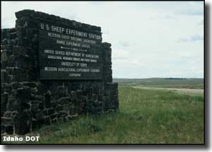
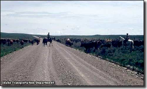
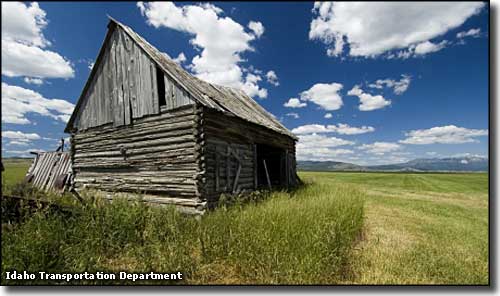
Lost Gold Trails Loop is a 48-mile drive through the scenic high latitude desert area just south of the Centennial Mountains and west of Yellowstone. The Beaver Creek Valley (between Dubois and Spencer) was part of the main route for gold prospectors traveling to the gold mines in Montana in the late 1800's (that's where the "Lost Gold Trails" name comes from). Stage coaches ran through the valley for years until the Oregon Short Line Railroad arrived and built through in 1879. Dubois was originally known as Dry Creek but was renamed in honor of Fred Dubois, an Idaho Senator who was instrumental in helping Idaho become a state. The town wasn't much until the railroad built a new Roundhouse Station there in 1892. The first real church in town was built in 1905 and is now the Heritage Hall Museum. Dubois grew up to service the sheep and cattle ranches in the area. Most farming was centered around the growing of hay, and even now, the hay grown in this part of Idaho often makes its way as far as Florida. Lost Gold Trails Loop departs downtown Dubois on Idaho Highway 22, crosses west over the bridge over the Interstate and then turns north on Old US Highway 91 to make the run to Spencer. In between Dubois and Spencer you'll pass the entrance to the USDA Sheep Experiment Station, a location where sheep research has helped turn out three new species of genetically-modified and commercially successful sheep. About 3 miles south of Spencer is China Point. The name comes from an incident during a blizzard when a group of Chinese men in a stagecoach were halted by the heavy snow. The Chinese were on their way to the goldfields in Montana to be cooks for various of the mining operations there. The stage driver tried to persuade them to abandon the stage and ride the horses into town but they refused. They ended up freezing to death and were buried nearby. Spencer was originally a Wood Livestock Company town on the Oregon Short Line Railroad but over the years, that livestock industry has dwindled (and there's no Oregon Short Line Railroad anymore either). About 60 years ago, a hunter in the woods northeast of town stumbled across a large opal embedded in volcanic rock lying on the ground. Today, Spencer is known for the quality of the opals dug out of the volcanic rock at a couple places in the nearby hills. A fair bit of the local business revolves around the production and sale of opals and other gems so you might want to check out some of the gem shops as you go through town. The Loop route then heads east on the Spencer-Idmon Road to the intersection with County Road A-2 at Idmon (Idmon is a ghost town now). Turn right (south) and share the road with the Fort Henry Historic Byway for a few miles, then turn right (southwest) at the fork and continue following the A-2 back to Dubois. A lot of the countryside Lost Gold Trails Loop passes through has been dedicated to the raising of sheep and cattle since the big influx of easterners in the late 1800's and early 1900's. What isn't grassland is mostly covered in sagebrush with clumps of juniper in spots. Between Spencer and Idmon the countryside has a bit more character and offers more tree cover. This is an area where the big wildlife consists of pronghorns, deer and elk with a few bears and bobcats around. The elk tend to stay higher in the mountains most of the year but come down the hill for the winter. Near Spencer is the USDA Sheep Experiment Station, a place established in 1915 by President Woodrow Wilson for research into producing "better" sheep. The Targhee, Polypay and Columbia breeds have been developed here. The other legs of the loop are along old Nez Perce trails from the days when they crossed over the Rockies to hunt bison. |
 At the site of Idmon 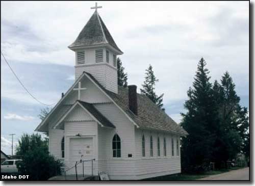 Heritage Hall, the Dubois History Museum 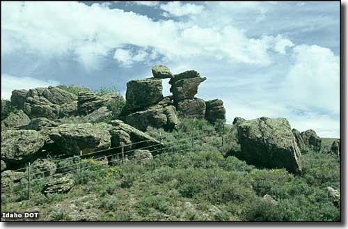 China Point 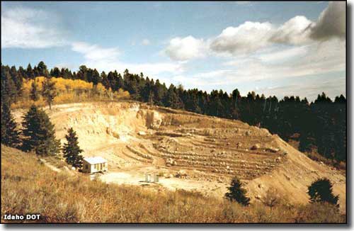 An opal mine northeast of Spencer 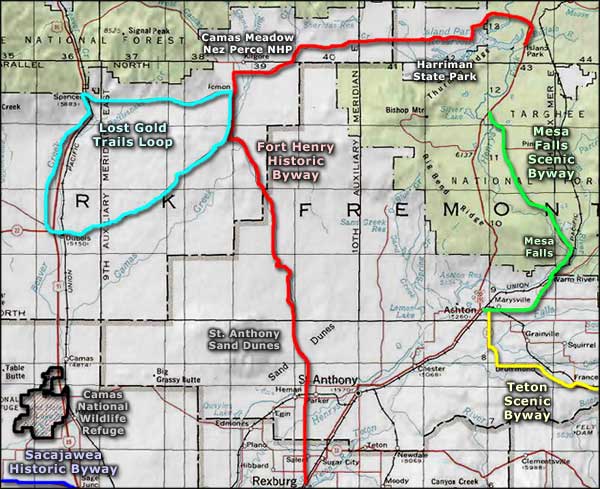 Lost Gold Trails Loop area map |
|
|
 |
| Index - Arizona - Colorado - Idaho - Montana - Nevada - New Mexico - Utah - Wyoming National Forests - National Parks - Scenic Byways - Ski & Snowboard Areas - BLM Sites Wilderness Areas - National Wildlife Refuges - National Trails - Rural Life Advertise With Us - About This Site - Privacy Policy |
| Photos courtesy of the Idaho Transportation Department. Area map courtesy of National Geographic Topo! Text Copyright © by Sangres.com. All rights reserved. |