 |
Wells, Nevada |
 Wells, Nevada |
|
Just west of the town of Wells is the source of the Humboldt River, in a swampy area that is fed by springs. Travelers along the California Trail referred to the location as "Humboldt Wells." When the Transcontinental Railroad was built through here in 1869, the Central Pacific Railroad built a water tower and a railroad siding here. They installed a boxcar next to the tracks for use as a passenger and freight depot. On Christmas Eve, 1869, the folks celebrated the opening of the first permanent structure in the town of Humboldt Wells: a log hut containing the Bulls Head Saloon. Then they built another saloon, a telegraph office, livery stable and general store. Shortly, Wells was a freight division point and helper station, serving the miners and ranchers in the local area. In 1873 the town had its name officially shortened to "Wells." In the 1880's the mining business fell off but there was a short revival in the 1890's with new activity in the Cherry Creek area and an new boom near Ely. The Ely copper mines freighted their ore to Wells until the Nevada Northern Railroad built a line from Ely to Cobre (east of Wells) and all the copper ore was shipped in that direction. Over the years, the importance of Wells to the railroad (and vice versa) has declined but Wells is still important as a stopping point on the I-80 and supply center for the surrounding countryside. On February 21, 2008, there was an earthquake rated at 6.0 that was centered about 6 miles below the surface and about 5 miles northeast of town. It shook the whole of northeastern Nevada but Wells took the most damage. |
| Fast Facts about Wells, Nevada |
|
Wells, Elko County, NV 89835
Incorporated: 1921 Elevation: 5,630' Latitude: 41.1095°N Longitude: 114.9688°W Resident Racial Breakdown: White Non-Hispanic: 71.8% Hispanic: 19.5% Native American: 8.2% Other: 9.1% Two or More Races: 3.5% Education: High School or Higher: 78.7% Bachelor's Degree or Higher: 16.0% Graduate or Professional Degree: 5.8% 2009 Estimates: Population: 1,315 Males: 681 Females: 634 Median Resident Age: 35.7 Years Estimated Median Household Income: $55,175 Estimated Median Home Value: $183,860 Population Density: 191 People per Square Mile 2009 Cost of Living Index for Wells: 83.1 Major Industries: Entertainment & Recreation, Construction, Educational Services, Lodging & Food Services, Transportation Services, Utilities, Agriculture, Retail Services, Government Unemployed: 5.9% |
|
|
Elko County Related Pages
Carlin - Elko - West Wendover - Elko County - Elko Snobowl
South Fork State Recreation Area - Wild Horse State Recreation Area Humboldt-Toiyabe National Forest - Ruby Mountains Wilderness Jarbridge Wilderness - East Humboldt Wilderness - Ruby Lake National Wildlife Refuge California Trail Back Country Byway - Bruneau River Loop Back Country Byway Angel Lake Scenic Byway - Carlin to Golconda Proposed Back Country Byway Nevada Pages |
 |
| Index - Arizona - Colorado - Idaho - Montana - Nevada - New Mexico - Utah - Wyoming National Forests - National Parks - Scenic Byways - Ski & Snowboard Areas - BLM Sites Wilderness Areas - National Wildlife Refuges - National Trails - Rural Life Advertise With Us - About This Site - Privacy Policy |
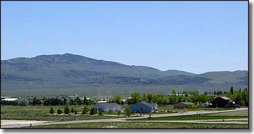
| Upper photo of Wells, Nevada courtesy of Daniel Mayer, CCA ShareAlike 3.0 License. Text Copyright © by Sangres.com. All rights reserved. |