Kanab, Utah

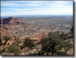
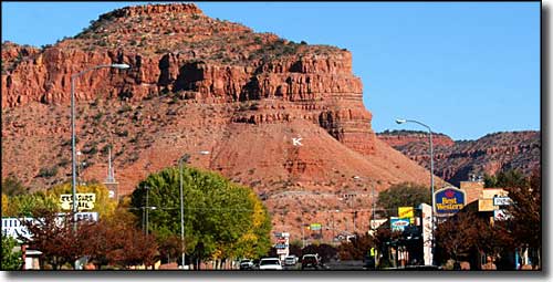
Along US Highway 89 in Kanab, Utah

The settlement at Kanab was marked by Mormon pioneer Jacob Hamblin when he built a dug-out cabin here in 1858. "Kanab" is the Southern Paiute word for "place of willows." Later Mormon settlers built Fort Kanab in 1864 to protect themselves from local Paiutes. After multiple Indian attacks, the fort was abandoned in 1868 and most of the folks left the area. New settlers arrived in 1870, coming from Salt Lake City, Cottonwood and the abandoned mission on Nevada's Muddy River.
In the early days this was cattle ranching country. Then Kanab became a resting point for Mormon polygamists on their way to the area of what is now Colorado City, Arizona. Probably the biggest business in Kanab these days is tourism.
Kanab has a long history as a locale for the shooting of Hollywood Westerns: Daniel Boone, Gunsmoke, The Outlaw Josey Wales, Stagecoach, McKenna's Gold and The Lone Ranger were all filmed in the neighborhood. Part of Planet of the Apes was filmed here, too. The reasons for all the movies: Kanab's central location between the North Rim of Grand Canyon National Park, Zion National Park, Bryce Canyon National Park, Grand Staircase-Escalante National Monument and Coral Pink Sand Dunes State Park. You'll also find Pipe Spring National Monument and Grand Canyon-Parashant National Monument close by.
About five miles north of Kanab is where you'll find the Best Friends Animal Sanctuary, probably the largest animal sanctuary on Earth. Best Friends owns about 3,300 acres outright and leases another 33,000 acres from the Bureau of Land Management. Their effort here is to provide sanctuary for pets and domesticated animals that would most likely be euthanized anywhere else. 22 of Michael Vick's most abused fighting dogs came to Best Friends for care and rehabilitation. At any one time, there are about 2,000 animals on the property, mostly cats and dogs but also birds, rabbits, horses, burros, goats and pot-bellied pigs. Euthanasia is used on this property only when an animal is terminally ill and/or in extreme pain.

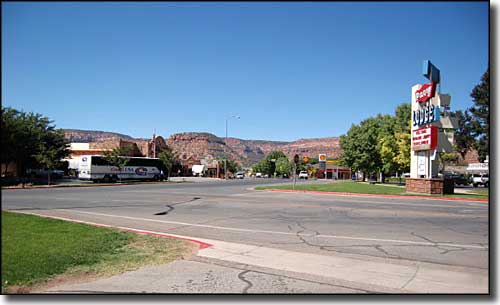
On Center Street in Kanab
Latitude: 37.0355°N
Longitude: 112.5311°W
Settled: 1870, Incorporated: 1885
Elevation: 4,970'
Education:
High School or Higher: 86.7%
Bachelor's Degree or Higher: 23.3%
Graduate or Professional Degree: 8.8%
2011 Cost of Living Index for Kanab: 83.5
Median Resident Age: 40.1 Years
Estimated Median Household Income: $40,100
Estimated Median Home Value: $213,300
Population Density: 271 People per Square Mile
Major Industries:
Lodging & Food Services, Health Care, Construction, Government, Repair & Maintenance, Educational Services, Utilities, Religious Organizations, Transportation Services, Professional Services, Agriculture, Miscellaneous Manufacturing
Unemployed (March 2011): 10.3%
Population Demographics: 2010
| Total Population | 4,312 |
| Males | 2,089 |
| Females | 2,223 |
| Population by Age | |
| Under 18 | 1,094 |
| 18 & over | 3,218 |
| 20-24 | 184 |
| 25-34 | 476 |
| 35-49 | 672 |
| 50-64 | 912 |
| 65 & over | 864 |
| Population by Ethnicity | |
| Hispanic or Latino | 180 |
| Non Hispanic or Latino | 4,132 |
| Population by Race | |
| White | 4,148 |
| African-American | 12 |
| Asian | 12 |
| Native American | 43 |
| Hawaiian or Pacific Islander | 0 |
| Other | 35 |
| Two or more | 62 |
