|
||||||||||||
|---|---|---|---|---|---|---|---|---|---|---|---|---|
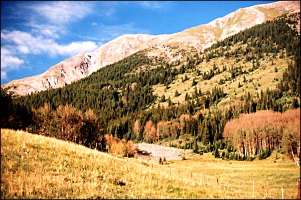
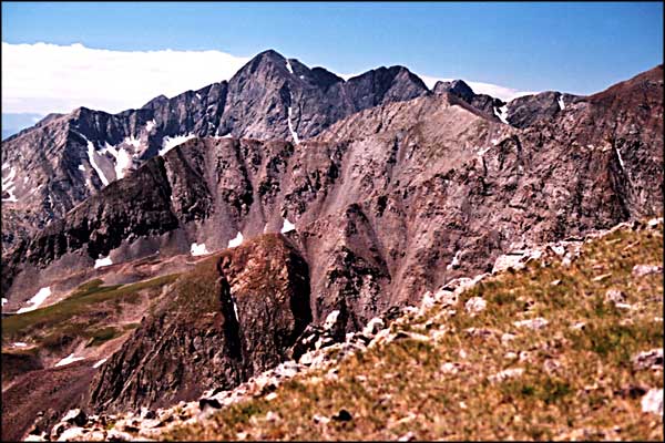
California Peakone of the 100 highest peaks in Colorado |
||||||||||||
|
|
||||||||||||
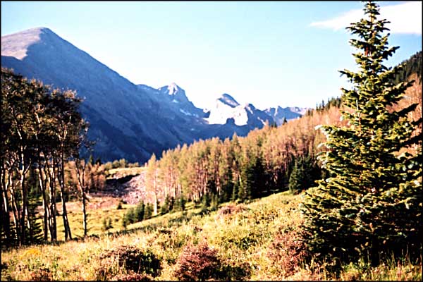
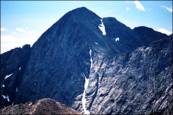
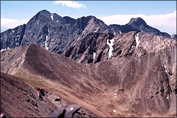
 This photo of California Peak was taken while climbing to Mt. Lindsey (California Peak is that dark peak in the center) |
||||||||||||
California Peak is located along the spine of the Sangre de Cristo Mountains directly north of Mt. Blanca. Access from the west is through the Zapata Ranch subdivision, a gated community, or up the hill from Zapata Falls. Access from the east is from the Upper Huerfano Valley via the Zapata Trail or via Lily Lake. Bill and I chose to climb the Zapata Trail, which leaves the valley about a mile north of the trailheads for Mt. Lindsey, Mt. Blanca and Lily Lake. The trail starts off pretty steep up through some heavy timber, crossing several small creeks as it goes. Up about a mile it levels out in a beautiful meadow. Here you go through a gate in the barbed wire fence and almost immediately lose the trail. There are markers (cairns) but they are few and far between. On our descent we followed the trail easily and found exactly where we lost it on the way up. We entered the meadow and headed south onto a small rock pile and couldn't see any more markers. If we had continued south for another fifty yards or so we'd have found the trail easily but we didn't. Instead we headed out into what looked like an easy sloping meadow to the northwest and headed straight for the saddle we could see on the ridge above. Miscellaneous overgrown jeep trails in the area were not helpful. We ended up bushwhacking another mile up the hill into a large area of blowdown and spent a lot of energy climbing through the tangled fallen tree trunks. However, at the top of the blowdown we found the real trail and followed it up onto the saddle on the ridge. At the crest of the ridge we found a sign marking the boundary of the Sangre de Cristo Wilderness Area. From this point, the Zapata Trail continued on over the ridge and down. We turned south and went up a reasonably easy grass slope. As we went up, the grass gave way in spots to bowls of talus. The view to the northwest was out over the Great Sand Dunes, Kit Carson Mountain and the Crestones rising behind. We were watching clouds forming below us on the west side and blowing up and over us, only to clear the ridge and dissipate again on the east side. |
||||||||||||
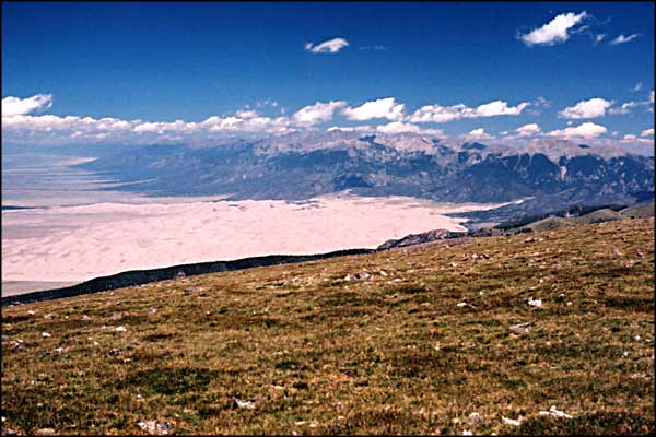
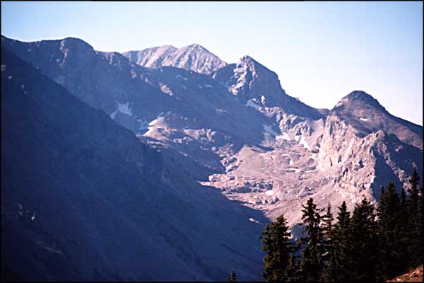
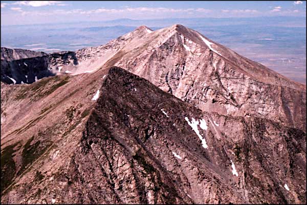
 California Peak from the San Luis Valley |
||||||||||||
|
It was a different climb. We would come over a knoll only to descend for 200 feet and climb 300 feet up another knoll. Most of the way we were kept company by the dropoff immediately to the east of us. At times we contoured west to go around a knoll or two but that edge was with us almost all the way to the summit. The problem: which knoll is the summit? Finally we reached a place where there was only rock above us and no vegetation. We traversed to the west, actually spiralling upwards towards what turned out to be California Peak itself, finally. You'll know that you are there because it is more stark with looser material than anything else around. There is a summit cairn and the register is kept by the Republic of Texas Mountaineering Club. We signed, had lunch, took pictures of the surroundings and headed back down. I think it's about 8 miles roundtrip and we were 7 hours. Up on the ridge the wind just blows, so be prepared. |
||||||||||||
| Clicking on any of these photos will open a new window or new tab in your browser and bring you a larger version of that photo. |
||||||||||||
| ||||||||||||
 California Peak area map |
||||||||||||
|
|
||||||||||||
California Peak Related Pages
Blanca Peak - Ellingwood Point - Mt. Lindsey - Little Bear - Traverses - Sierra Blanca
Como Lake - Como Lake Road - Zapata Falls National Recreation Area Colorado Pages
Towns & Places - Scenic Byways - State Parks - BLM Sites - History & Heritage Ski & Snowboard Areas - Photo Galleries - Colorado Mountains - Scenic Railroads Unique Natural Features - Wilderness Areas - Outdoor Sports & Recreation Colorado's National Forests - National Wildlife Refuges - Colorado's National Parks |
||||||||||||

|
||||||||||||
| Index - Arizona - Colorado - Idaho - Montana - Nevada - New Mexico - Utah - Wyoming National Forests - National Parks - Scenic Byways - Ski & Snowboard Areas - BLM Sites Wilderness Areas - National Wildlife Refuges - National Trails - Rural Life Advertise With Us - About This Site - Privacy Policy |
||||||||||||
| Photos courtesy of Sangres.com, CCA ShareAlike 3.0 License. Map courtesy of National Geographic Topo! Text Copyright © by Sangres.com. All rights reserved. |