 |
Fallon, Nevada |
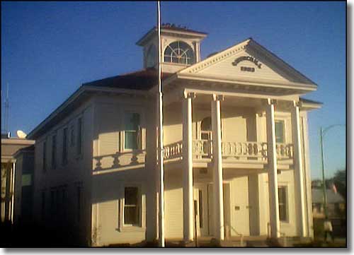 Churchill County Courthouse in Fallon |
|
Mike and Ezra Fallon established a ranch here in 1896. The local post office was in their ranch house and Jim Richards built his mercantile close by. The local Native Americans referred to the place as "Jim's Town" until 1902. That year saw Congress pass the Reclamation Act of 1902, which established the United States Reclamation Service. This was the beginning of a national reclamation service that was financed through the sale of public lands. One of the first projects considered was the "reclamation" of desert lands in west-central Nevada. In 1902, Mike Fallon sold his ranch to Warren W. Williams, a land speculator from Maine who platted the ranch and began to advertise the sale of lots. While Williams was selling lots on the western side of Fallon, John Oats was platting the east side of town and starting to sell it. 1903 saw the county seat moved from Stillwater to the new town at Fallon, a move pushed through the state legislature by then State Senator Williams. A new courthouse was built and the town was off and running. Almost from the very beginning of the irrigation project, Fallon prospered. The Derby Diversion Dam was built on the Truckee River, then the 36-mile Truckee Canal was begun in 1905. 1912 saw electricity generated from below Lahontan Dam reach Fallon. In 1914, the Lahontan Dam was completed and homesteaders flocked into the area. However, the city's population never reached the estimated 20,000 because the plan of the original irrigation project was never fully realized. "Hearts-O-Gold" cantaloupes were the big local agricultural product in the 1920's and 1930's. Because of the unmatched flavor and quality of the jumbo-sized melons, Churchill County had a near monopoly on cantaloupe sales in Nevada and northern California. The second big agricultural product was domesticated turkeys, some of which were served at the White House for Thanksgiving dinner. These days, the big money-maker for farmers is alfalfa. The farmers in the Lahontan Valley produce an average 5 tons per acre and ship more than 70% of their product to feed lots and dairies out of state. Cantaloupes are still grown but usually just for local consumption. The Fallon Naval Air Station came into existence in 1942. Since 1972, the base has specialized in pilot training. The main east-west route through Fallon is US 50, often called "the Loneliest Road in America." The next town east of Fallon is Austin, 110 miles. |
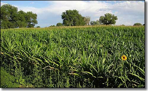 Corn field near Fallon |
| Fast Facts about Fallon, Nevada |
|
Fallon, Churchill County, NV
Zip Codes: 89406, 89407, 89496 Incorporated: 1908 Elevation: 3,960' Latitude: 39.4728°N Longitude: 118.7788°W Resident Racial Breakdown: White Non-Hispanic: 76.5% Hispanic: 9.9% African-American: 2.0% Native American: 4.7% Other: 3.4% Two or More Races: 4.5% Filipino: 3.6% Education: High School or Higher: 83.6% Bachelor's Degree or Higher: 13.2% Graduate or Professional Degree: 4.8% 2009 Estimates: Population: 8,544 Males: 4,179 Females: 4,365 Median Resident Age: 32.3 Years Estimated Median Household Income: $42,770 Estimated Median Home Value: $186,050 Population Density: 2,805 People per Square Mile 2009 Cost of Living Index for Fallon: 88.2 Major Industries: Government, Lodging & Food Services, Construction, Health Care, Retail Services, Educational Services, Metal & Metal Products, Transportation Services, Social Services, Mining, Entertainment & Recreation Services Unemployed: 4.5% |
|
|
 |
| Index - Arizona - Colorado - Idaho - Montana - Nevada - New Mexico - Utah - Wyoming National Forests - National Parks - Scenic Byways - Ski & Snowboard Areas - BLM Sites Wilderness Areas - National Wildlife Refuges - National Trails - Rural Life Advertise With Us - About This Site - Privacy Policy |
| Photo of the Fallon corn field courtesy of M. Chavez. Text Copyright © by Sangres.com. All rights reserved. |