Peak to Peak Scenic Byway

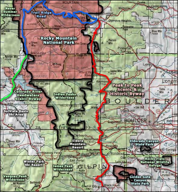
Established in 1918, this is Colorado's oldest scenic byway. The gravel roads criss-crossing the main highway lead to high country lakes, trailheads, campgrounds, ghost towns, and a string of other world class attractions. Less than an hour from Denver, Boulder or Fort Collins, this road provides matchless views of the Continental Divide and the Front Range.
Most of the towns along this route are left-overs from the gold mining heyday of Colorado. Some, like Nederland, have been somewhat resurrected as residential centers, while others, like Blackhawk and Central City, have been "saved" as "low-stakes gaming centers."
The photos on this page were all taken on a Friday afternoon in late August. Once I got past Blackhawk there was hardly any traffic, although there were a lot bicyclists along the way. And up near Allenspark I came across the Saint Malo Sanctuary, a pleasant surprise at the eastern foot of Mt. Meeker, one of Colorado's 100 highest peaks. I followed Route 7 right down into Estes Park where the traffic was as bad as it would be in any small city at the edge of a major National Park (Rocky Mountain National Park)...
I tried but these photos just don't do the Peak to Peak Scenic Byway justice.


The Indian Peaks to the west

Closer to the Indian Peaks

Site of an old gold mine along the road

Looking down to the east

Mt. Meeker from the south

The Twin Sisters to the east

The Saint Malo Sanctuary, Mt. Meeker in the background

Looking west across Mary's Lake, coming down to Estes Park

Peak to Peak Scenic Byway area map
